Well Logs and Well Reporting

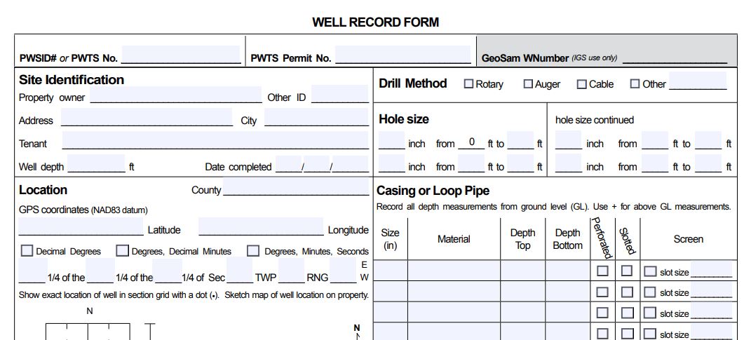
Screen image and link for IGS/IIHR Well Log Form

A well log is a crucial source of information that documents the construction of a water supply well. Having a written record detailing the well's construction is more accurate than trying to remember the information when needed. Detailed well logs contain information like the types and thickness of each geological sequence encountered, the types of materials used in the well's construction, the construction techniques used as the well was installed, the water levels of the aquifer(s) while at rest and when pumping, how much water the well will provide and then name and contact information of the certified well contractor(s) who provided oversight during well construction. The well log not only provides the well owner with an important tool that can help troubleshoot the well if problems develop, it is a requirement in Iowa for all new well construction.


GeoSam Database

The GeoSam Database is maintained by The Iowa Geological Survey, and is part of The University of Iowa IIHR — Hydroscience & Engineering. The information available in GeoSam can be used by drillers, consultants, engineers, property owners, and the general public to aid in estimating the depth to major geologic features, well depth and construction concepts, water yield of specific aquifers and other site specific information needs. Additional information regarding the GeoSam database can be obtained by contacting The University of Iowa IIHR — Hydroscience & Engineering.

GeoSam Database

Iowa DNR Private Well Tracking System (PWTS)

The DNR has an online database that contains information for some of the wells installed in Iowa. The private water supply well records that are available as public records can be found in the Iowa DNR Private Well Tracking System (PWTS) database. This data source may contain information regarding wells in your area of interest.

One common question that we routinely answer relates to the availability of well logs for all water wells found within our state. Unfortunately, the state does not maintain a single data source that provides well information for every well that has been installed throughout history - This type of information does not exist.

Iowa DNR Private Well Tracking System (PWTS)

Iowa Well Forecasting System (IWFoS)

The Iowa Well Forecasting System (IWFoS) is a web platform developed by the University of Iowa Hydroinformatics Lab (UIHI Lab), the Iowa Geological Society (IGS), and the Center for Health Effects of Environmental Contamination (CHEEC) at the University of Iowa. IWFoS provides a user-friendly and interactive environment for Iowa regarding well information, including aquifer depths and water quality. This historical data is available in IWFoS through publicly available data from the Iowa Department of Natural Resources, including water quality from the Private Well Tracking System and well geology from GeoSAM. Because the intent of IWFoS is to better inform the drilling of new wells, we include information from these databases regardless of whether the wells shown are still active so as to provide as much data as possible to improve decision making. This is a beta version which in actively being developed. Its functions and all information are provided on an "as is" and "as available" basis.

Iowa Well Forecasting System (IWFoS)