Read more about the work in Charles City, and other water quality successes, in Working For Clean Water, the DNR's annual watershed success story publication.
After Cedar River floodwaters hit hard in 2008 and 2016, even washing away the iconic century-old suspension bridge in 2008, you wouldn’t expect Charles City to embrace the river.
Instead, the town’s made the Cedar a destination and works to protect it. The vision of a downtown whitewater park began in 2006 and quickly grew into a full-blown riverfront redevelopment, and has been paired with water quality improvements. “The Cedar has always been a uniting feature,” says Mayor Jim Erb. “This tends to fit in that history and provide a foundation for everything to economic development, recreation, conservation and environmental benefits.”
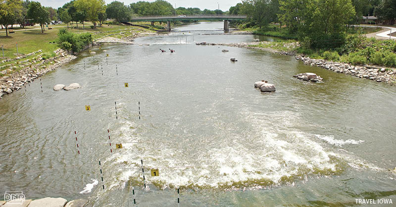
 With grants and local donations, Charles City hired a respected Colorado firm to design the whitewater course. Plans came together to turn a little-used park into a major draw with a boat launch, amphitheater, ravine play area and stormwater fountain. Ensuring the safety of course users meant removing the low-head “beauty” dam, despite some anglers’ reservations. However, that allowed fish back upstream and created habitat. “Never fails – you go over the Brantingham bridge and you’ll see somebody out there,” says Steve Diers, City Administrator.
The park, which covers 26 acres of land and 11 acres of water, officially opened in summer 2011, drawing residents riverside, and luring kayakers from Iowa, Nebraska, Minnesota, Wisconsin, and even the coasts. “I was impressed with the community coming out to watch the boaters and use the river. I saw kids out fishing, older folks out for a stroll. Everyone was extremely nice and welcoming,” said Omaha paddler Marijo Bosiljevac in 2011. “It was clear from the start that the investment in the river created a beautiful and usable space for the community.”
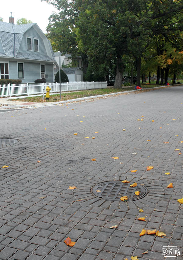
Torrential rains in September 2016 put the town’s hard work to the test, when 6 inches of rain fell in one night alone. “It’s held up well and performing as designed,” says Diers. The work extends beyond the park – 15 blocks of a historic neighborhood just upstream, where homes and infrastructure date back 100-plus years, were repaved with cobblestone-esque permeable pavers following the 2008 floods. Along with vegetated bioretention strips, rainfall now soaks through into the ground, easing street and basement flooding. The pavers and plants slow runoff and filter pollutants before they reach the river. The system can handle up to 7 inches of rain in one day at one intersection. The system should last 50 years and will likely cut nitrogen reaching the river from the neighborhood by 65 to 100 percent and phosphorus from 30 to 65 percent. “There’s been no real pushback. People like the cosmetics of the design and appearance of the new streets,” Erb says. Diers adds, “In winter, those are the first streets to melt – it just sucks the water away.”
Other cities visit to tour the work. The city, building off its success, is working with private developers for permeable pavers in new housing developments and partners with groups and landowners north of town to use conservation practices like cover crops, bioswales, no-till and more. “Hopefully we can have less water coming in to Charles City,” says Diers. “And to restrain nitrates and keep them where they do the most good,” adds Erb.
The city’s participation in the Upper Cedar Watershed Management Authority also works to improve conditions for other communities along the Cedar. “They’re very concerned with what happens upstream and the effect that they have downstream,” says the Upper Cedar chair, Sherman Lundy. “The city has been a key player in the Upper Cedar WMA and has taken the lead with Floyd County as an integral part of the WMA.”
